Garmin Navionics+ charts feature vibrant colors, a streamlined user interface, combined coastal/inland content, and the popular Navionics®-style color palette. It allows you to easily plan a route using the products of the market's most popular boating chart manufacturer.
- Use our most comprehensive open sea and inland water maps on your Garmin chartplotter.
- See the world your way. You can customize the view with many combinations of map layers and overlays.
- Thanks to the one-year subscription you get on top of the store, you get access to daily updates via the ActiveCaptain® application for smart devices.
- When using Auto Guidance+™ technology2, you can use suggested routes between marinas for navigation.
- You can find out the best fishing spots by choosing up to 10 target depth areas shaded in different colors.
Coverage:
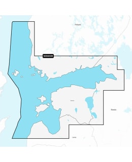
Detailed coverage of the Gulf of Finland from Åland to and including St. Petersburg, Russia; the Gulf of Riga; Lakes Peipus and the Narva River. Coverage includes the ports of Turku, Helsinki and Kotka, Finland; Vyborg, Kronstadt and Lomonosov, Russia; Tallinn, Estonia and Riga and Ventspils, Latvia.
Compatible devices:
ECHOMAP UHD 72cv
ECHOMAP™ UHD 72sv
ECHOMAP™ UHD 92sv
ECHOMAP™ Ultra 122sv
GPSMAP® 1022
GPSMAP® 1022xsv
GPSMAP® 1222
GPSMAP® 1222xsv
GPSMAP® 1222xsv Plus
GPSMAP® 1223
GPSMAP® 1223xsv
GPSMAP® 723
GPSMAP® 723xsv
GPSMAP® 8410
GPSMAP® 8410xsv
GPSMAP® 8412
GPSMAP® 8412xsv
GPSMAP® 8416
GPSMAP® 8416xsv
GPSMAP® 8417 MFD
GPSMAP® 8700 Black Box
GPSMAP 922xs Plus
GPSMAP® 923
GPSMAP® 923xsv
Volvo Penta Glass Cockpit system